Last Updated on May 16, 2025 by The HD Post Staff

CALIFORNIA – The California Department of Fish and Wildlife (CDFW) announced May 15, that it released a new mapping tool designed to provide regular location information on GPS-collared gray wolves in California to help prevent wolf-livestock conflict.
The Wolf Location Automated Mapping System, available to the public on CDFW’s website, shows the approximate location of GPS-collared wolves across the state.
Gray wolves are protected under both the federal Endangered Species Act and the California Endangered Species Act (CESA), making it unlawful to harm, harass, or kill them.
California Cattlemen’s Association vice president of government affairs Kirk Wilbur said the mapping tool will empower ranchers to better understand where wolves might threaten their livestock, enabling them to increase human presence.
14 wolves are collared across California
According to CDFW, there are seven confirmed packs in California:
- Beyem Seyo pack (Plumas County);
- Diamond pack (Plumas and Lassen counties);
- Harvey pack (Lassen County);
- Ice Cave pack (Shasta, Tehama, Lassen, and Plumas counties);
- Lassen Pack (southern Lassen/northern Plumas counties);
- Whaleback Pack (Siskiyou County) and
- Yowlumni pack (Tulare County).
As of May 2025, 14 wolves in California have GPS collars. Wolves within a pack often move independently, so the location of a collar does not always represent the whereabouts of the entire pack.

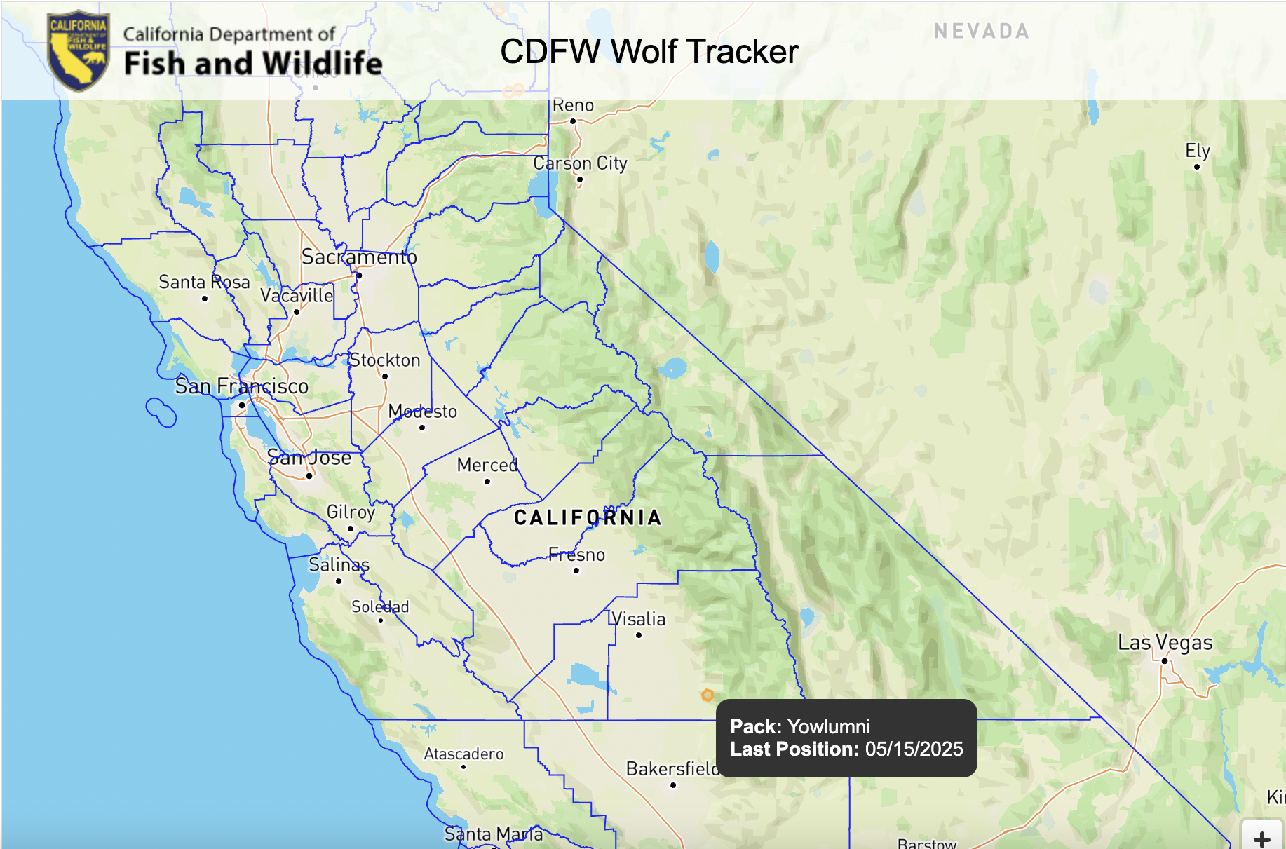 Photo Credit: CDFW
Highlighted hexagons on the map represent the most recent locations from the collars themselves.
Although satellite collars do not provide real-time location information, they do attempt to send location data every morning.
CDFW said it reserves the right to modify or discontinue the publication of the mapping tool if it is believed to result in any harassment of gray wolves or other wildlife or trespassing on private property.
To view the map visit https://wildlife.ca.gov/Conservation/Mammals/Gray-Wolf/Location-Map
